Supporting builders, civil contractors and developers across Greater Sydney and Regional NSW with clear communication, fast turnaround and dependable outcomes.
We integrate into your team to keep set-out accurate, risks visible and deliverables audit-ready.
From early works through to conformance, GDSurv provides practical surveying support that reduces rework, protects programme and improves decision making.
Set-out, verification and as-builts for commercial, industrial and infrastructure projects — with clear QA and site-first coordination.
Control networks, roads, services and pavements — delivered with practical site support and evidence-ready documentation.
Explore CivilHigh-detail point cloud capture for complex sites — supporting validation, modelling and accurate record drawings.
Feature and level surveys for design, planning and construction — delivered cleanly for CAD, engineers and consultants.
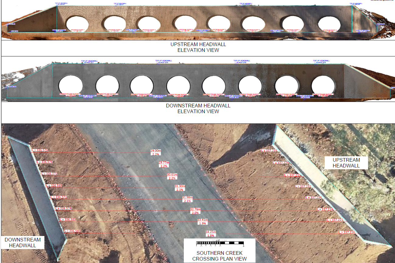
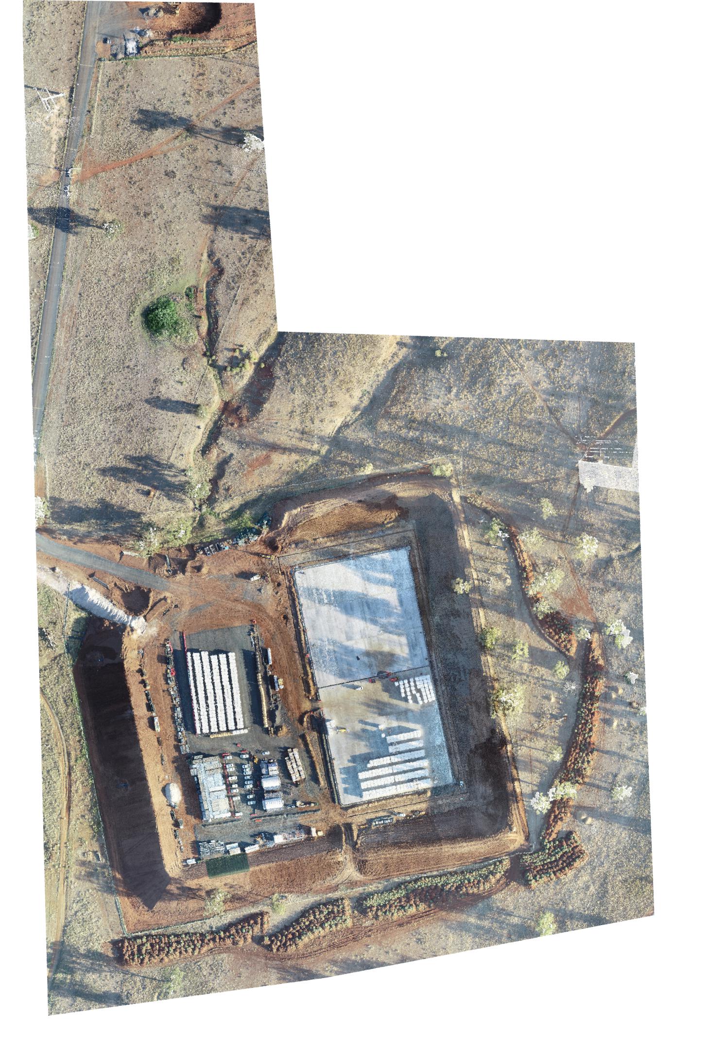
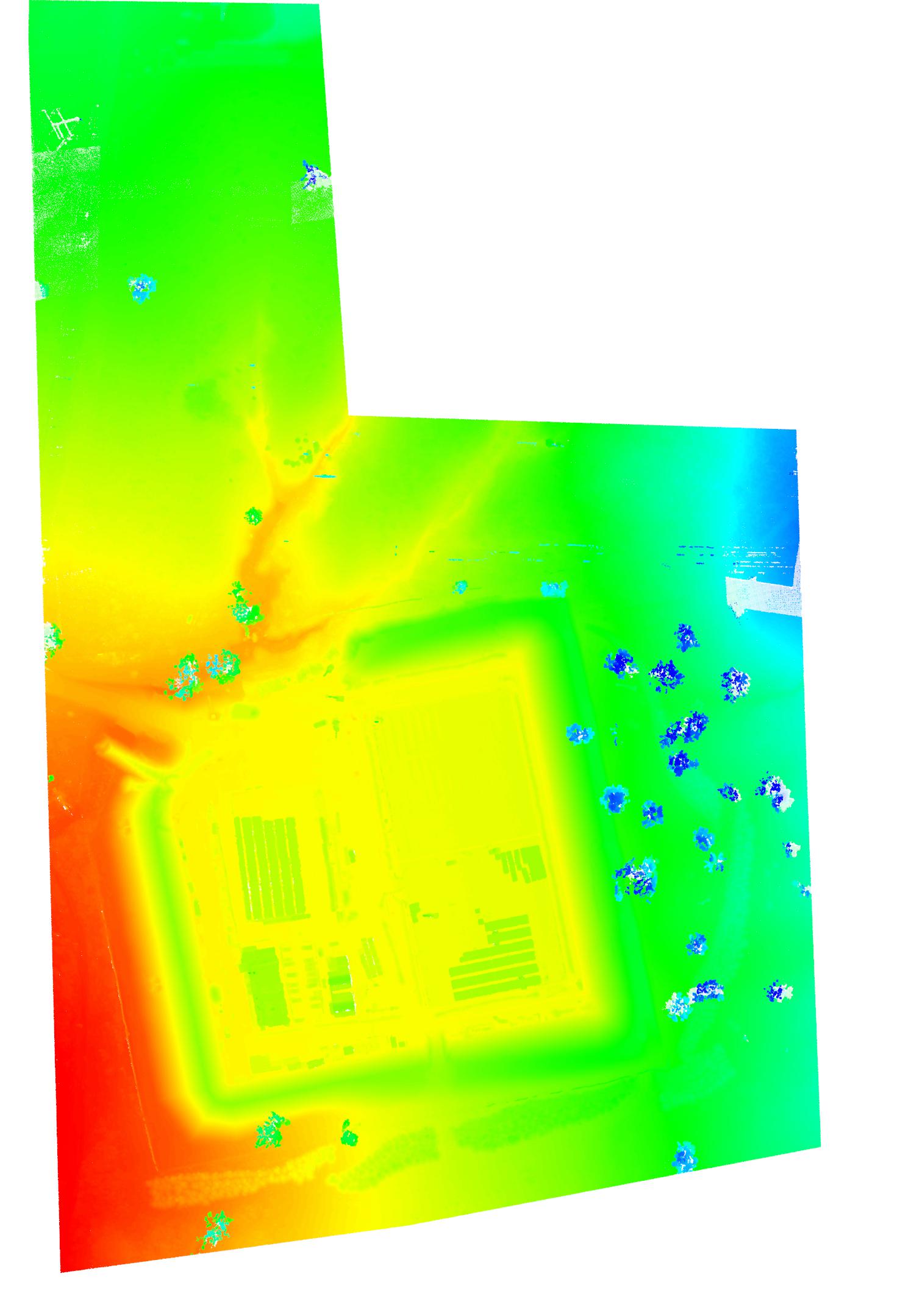
Explore TopographicalOrthophotos and terrain models for progress tracking, reporting and surface intelligence — fast visibility across large sites.
Ongoing movement monitoring for structures, excavations and adjacent assets — with clear reporting, thresholds and rapid escalation when required.
Explore Monitoring